
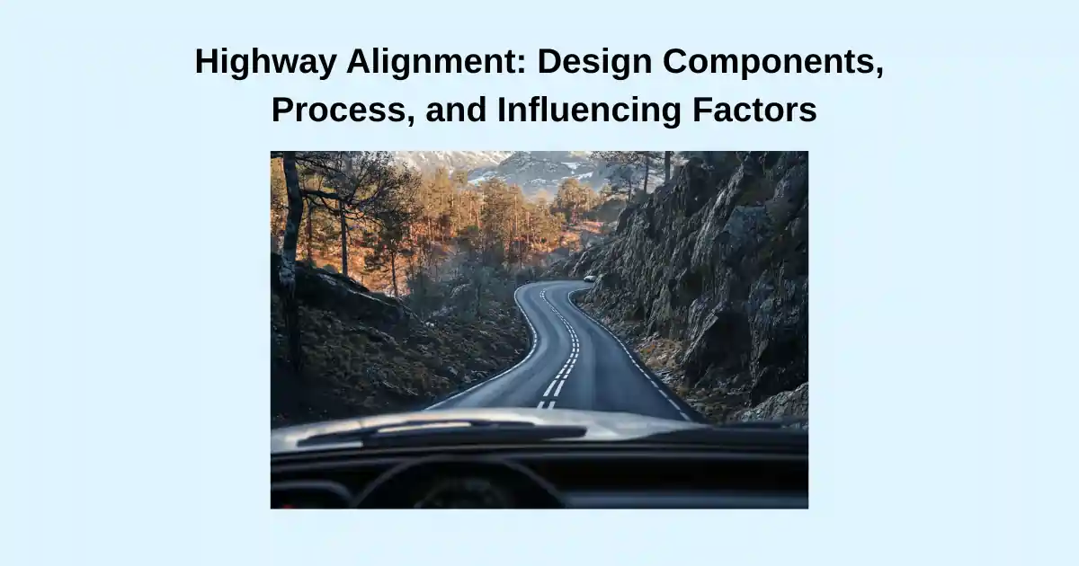
Highway alignment design is the foundation of highway planning, as it defines the road’s position and influences key design requirements. It establishes the three-dimensional layout of the roadway, with the centerline serving as the reference point for all other road components. Modern highway alignment design is implemented in a way that maximizes the total benefits after ensuring a careful balance of geometric requirements, environmental factors, economic constraints, and user safety considerations
What It Is Highway Alignment (and Why It Matters)
Highway alignment refers to the positioning of the centerline of a road or highway about its surrounding environment. It defines the direction through which the road will pass and serves as the backbone of roadway design.
Highway alignment is a multifaceted concept that integrates various engineering principles to ensure that roads are built safely and efficiently. It involves careful planning and consideration of numerous factors to create road networks that serve their intended purpose while minimizing negative impacts. The alignment chosen significantly affects not only the construction and maintenance costs but also the operational efficiency and safety of the road throughout its service life.
Improper road alignment can lead to several negative consequences. These include an increase in accident rates, higher construction and maintenance costs, increased vehicle operating costs, discomfort for road users, and decreased durability and strength of the road. Therefore, highway engineers must pay particular attention to alignment design to avoid these issues.
Components of Highway Alignment
Highway alignment consists of three primary components: horizontal alignment, vertical alignment, and cross-sectional elements. Each component plays a crucial role in the overall functionality and safety of the road.
Horizontal Alignment
Horizontal alignment defines the road’s position in space, focusing on its directional aspects. It typically consists of straight sections (tangents) connected by curves that allow for smooth transitions between directional changes.

In its basic form, horizontal alignment generally comprises a horizontal arc and two transition curves that form a curve joining two tangents. The geometric characteristics of horizontal alignment elements, such as the minimum radius of horizontal curves, maximum superelevation and the length of transitions, depend primarily on the design speed for which the road is designed. Proper horizontal alignment ensures that vehicles can navigate curves safely at the design speed without experiencing excessive centrifugal forces.

Transition curves are essential for providing a smooth change in curvature between straight sections and circular curves in road design. Clothoids are typically the preferred choice, as their geometry ensures a uniform rate of acceleration along the curve, enhancing comfort for road users.
However, due to the complexity of the clothoid’s mathematical formula, simpler alternatives or other types of curves are often used instead, as they are easier to set out during construction..
Vertical Alignment
Vertical alignment considers the elevation aspects of the road surface, which is also called profile of the road, including gradients (upward or downward slopes) and vertical curves that connect different gradient sections.

The profile of a road is the determining factor for choosing the best road alignment in mountain ranges since it is easier to discern the suitable slope changes in mountainous areas than horizontal directional changes.

Vertical alignments are considered as circular or often as parabolic curves. Circular vertical curves are used for calculations of visibility and design in some countries in Europe. However, in construction they are set out as parabolic curves. Parabolic curves are the standard vertical curves used in the USA.
Let us compare the use of circular and parabolic curves in vertical curves to understand the different characteristics of the curves.
The equation for a circular curve in L-Z plane with radius R can be written as:
L² + (Z + R)² = R²
or
Z = √(R² − L²) − R

But since the slope changes linearly, a quadratic parabola with R as a parameter is used:
Z = L² / 2R
This simpler formula is used to calculate the profile line’s height for staking out. In construction, it is normal practice that the vertical curves are considered as parabolas and are also based on the longitudinal profile inclinations.
By differentiating Z = L² / 2R, we get the slope Z’ = dZ/dL = L/R and the curvature ≈ Z” = 1/R.
The slope therefore changes linearly with the horizontal length coordinate L. So, the difference with clothoids curve is that in clothoid’s curve the curvature or second derivative is directly proportional to L and in parabolic curves the first derivative is directly proportional to L.
This can also be seen in the vertical curve templates used before the advent of engineering softwares for drawing vertical curves, where equal slopes are shown with evenly spaced lines.

The above figure is an example of vertical curve template with R = 8000 and with slopes indicated in ‰ (per mille)
This component of highway alignment is crucial for reducing energy consumption by ensuring appropriate road grades that facilitate efficient vehicle movement.
Vertical alignment influences driver visibility, drainage characteristics particularly sag curves, and the amount of earthwork required during construction. It consists of straight grades connected by circular or parabolic curves, which may be either crest curves (where two upgrades meet) or sag curves (where two downgrades meet).
Proper vertical alignment aims to keep the road as low as possible while incorporating gradual slopes that comply with design standards.
Cross-Sectional Elements
While not always classified as a separate alignment component, cross-sectional elements are integral to highway design. These include lanes, shoulders, curbs, medians, roadside slopes, ditches, and sidewalks. The cross-sectional design interacts with both horizontal and vertical alignments to create a three-dimensional layout for the roadway.

Source of photo: wikimedia
Cross-sectional elements define the width and configuration of the road, affecting traffic capacity, safety features, and drainage solutions. The appropriate cross-section design considers factors such as traffic volume, vehicle types, pedestrian requirements, and local environmental conditions. A typical cross section consists of the elements as shown in figure below.

Highway Alignment Design Process
The design of highway alignment adheres to a structured methodology that harmonizes engineering disciplines, regulatory frameworks, and multidisciplinary evaluations to balance safety, functionality, and cost-efficiency
The initial phase of highway planning involves selecting the optimal route. Different considerations are undertaken to select the best route. The route is assessed with respect to topography, prescribed design controls, socio-economic benefits, safety considerations, and overall road planning strategies.

Courtesy of photos: research gate
After the route is selected, the design process is refined by further detailing the design controls that guide the works of the final design . The design controls are obtained from the road design standards, regulations, plans and strategies and are controlled in an integrated manner from the route selection to the final design.
Route selection of highway alignment
The process of selecting highway alignments involves weighing several alternatives against several criteria. The most feasible route is selected after rigorous evaluation against the multifaceted criteria. Key considerations of criteria include:
1. Design Standards and Geometric Controls
– Horizontal alignment must adhere to parameters such as minimum curve radii, superelevation rates, maximum, and sight distance, which are dictated by design speed, traffic volume, and functional classification.
– Vertical alignment incorporates parabolic curves to ensure smooth transitions between grades, balancing topography, drainage needs, and sight distance.
2. Route Selection Factors
– Topography: Terrain classification (level, rolling, mountainous) influences alignment decisions, with mountainous regions requiring steeper grades and more complex curves.
– Obligatory points: Horizontal alignment along the routes may need to connect population centers, industrial hubs, or avoid obstacles like water bodies or unstable soil.
– Environmental and social impacts: Flood-prone areas, ecological zones, and community displacement risks are evaluated to minimize adverse effects.
3. Preliminary Design and Alternatives
– Multiple alignment options are drafted, considering various factors such as right-of-way costs, drainage structures, and existing infrastructure.
– Trial-and-error refinement: Alternatives are eliminated if they fail to meet design constraints (e.g., excessive cut/fill volumes, suboptimal sight distances, or non-compliance with safety regulations).
4. Final Selection Criteria
The chosen alignment is determined through:
– Cost-benefit analysis: Balancing construction expenses (e.g., bridging, excavation) against long-term operational savings.
– Stakeholder consultation: Public input and interdepartmental coordination (e.g., geotechnical, environmental, and structural teams) ensure regulatory compliance of design standards.

The process emphasizes iterative assessment, ensuring the final route optimizes safety, functionality, and sustainability while adhering to jurisdictional standards.
The following table shows the design constraints for route selection of a forest road.The criteria used for route selection are managed to suit the specific conditions of the project since road projects vary in the location, regulatory jusrisdictions, environmental, social and topographical conditions.

source:https://www.researchgate.net/
Horizontal Alignment Design
The horizontal alignment design process typically begins with route selection that involves identifying alternative routes and defining the centerline of the road. Engineers use topographic maps, aerial photographs, and field surveys to identify suitable alignments that balance different constraints and requirements.

The horizontal curves consist of circular arcs and straight lines. In between the straight and circular arcs are inserted transition curves which are parabolical,clothoids or cubical.
Key considerations in horizontal alignment design include:
1. Determining the minimum radius of horizontal curves
- Minimum radii based on design speed and allowable superelevation and side friction to minimize centrifugal forces (banking off the road on curves)
- Minimum radii by Calculating sight distance requirements to ensure visibility around horizontal and also required for vertical curves based on braking distance.
- Minimum radii based on Calculating minimum offset clearance between the centerline and potential obstructions on horizontal curves
2. Determining transition curve lengths to provide smooth entry and exit from circular curves
The horizontal curves should have the largest radius possible, and the minimum radius and short curves should be avoided as possible. The mixing of large and small radii should also be avoided rather to maintain uniform road characteristics.
It is important to avoid sudden changes in speed. The curves should be designed to blend aesthetically with the surroundings and align with the natural terrain
How to calculate the minimum radii of horizontal curves
The radii of horizontal curves is limited by the value of superelevation and side friction. The relationship between angles, friction, and velocity in curved motion is given by the equation

C/mg = v²/gR = tan(α + β)
Since the angles α and β are relatively small, we can allow ourselves the approximation tan(α + β) = tan α + tan β.
From the figure, we further get F/N = β. But F/N is also equal to the friction coefficient fs that is utilized in the lateral direction, tan α = E = the slope in the curve. We get:
v²/gR = E + fs (v in m/s)
In railways the analogous formula is. We can see in railways the superelevation is not limited by friction since there is negligible friction on steel wheels to rails contact.
v²/gR = hd/1500 + hc/1500
Hd: design cant: is the cant that is provided or constructed
Hc: cant deficiency is the difference between the theoretical can required to the cant constructed.
Minimum radius with consideration to side forces, For the relationship between speed (v), curve radius (R), superelevation (E), and utilized side friction coefficient (fs), we have derived the formula v²/gR = E + fs. With speed v expressed in km/h and g = 9.82 m/s² we get:
R = v²/[127·(E + fs)] (v in km/h)
The formula can be used to determine the minimum radius of a horizontal curve. One should then input the expected speed v in km/h and such values for E and fs that provide safe and comfortable driving. For a simple approximation formula, one can for example set E = 0.06 and fs = 0.10, which gives:
Rmin ≈ v²/20 (v in km/h)
Transition curves
Horizontal curves and straight line parts of the highway need to be joined by curves that ensure smooth transition for ensuring comfortable driving. The curvature of a curve is an important parameter considered in the design of transition curves.
Curvature of a curve is the rate of change of angle of a curve per its length. It is the measure of the degree of curve. Hence, the curvature of a circle is 1/R and is constant.

Source. wikimedia
The perfect choice for use as a transition curve are clothoids.
That is because the rate of change of angle per length (Curvature) of the clothoid, 1/R, is directly proportional to its length. That means 1/R=constant*L or R*L=constant. In mathematics, it is also called Euler’s spiral or Cornus spiral.
Clothoid is represented by the equation RL=(A)^2 where R is the radius at length L and A is the clothoid’s parameter.

For a circular curve with radius R and design speed of v, the following equations can be used for calculating transition curves.
Lmin=v3/(20R)
Amin=0.2*(v3)1/2

The superelevation along transition curves also needs to gradually change since the centrifugal force changes. Hence, the superelevation is rotated proportionally along the road to ensure a comfortable driving experience for the users.
Superelevation
Superelevation is a critical design element in highway engineering that involves raising the outer edge of a curved road section relative to the inner edge. This transverse slope serves several important purposes:
- It counteracts the centrifugal force experienced by vehicles traveling around curves, reducing the tendency for vehicles to skid or overturn.
- It allows vehicles to safely navigate curves at higher speeds than would be possible on a flat surface.
- It improves overall road safety and driver comfort when properly designed and implemented.

The rate of superelevation, denoted as “e”, is typically expressed as a percentage or a decimal representing the ratio of the pavement’s transverse slope to its width. The maximum superelevation rate varies depending on factors such as:
- Climate conditions (e.g., areas prone to snow and ice)
- Terrain type
- Urban or rural setting
- Design speed of the road
For example:
- Rural areas: typically up to 8% maximum
- Mountainous areas: often limited to 6% due to increased ice and snow risk
- Urban areas: usually 4% maximum or sometimes eliminated entirely
Superelevation is gradually introduced through a transition zone, where the road surface is rotated around a pivot point. This pivot point is usually at the centerline for undivided highways, while for divided highways, it’s typically at the inside edge of the traveled way.

Proper superelevation design is crucial for road safety and efficiency. However, it must be balanced with other considerations such as drainage, intersecting streets, and driveways, especially in urban areas.
The highest superelevation used in common roads is 10%, however, some few roads have as high as 12%. Superelevation above 8% are used in the absence of snow and ice.

The maximum superelevation for roads and the maximum friction are used to calculate the minimum curve radii for horizontal curves.
Vertical Alignment Design
Vertical alignment consists of straight lines with gradients uphill or downhill and curves. The curves considered can be circular or parabolic. Thus, vertical alignment design involves determining the gradients of straight sections, designing vertical curves (crest and sag,) and determining sight distances along the curves.

In the same manner as horizontal curves, vertical curves should have the largest radius or curvature as possible. Sharp curves should be avoided. The mixing of a large radius or curvature with a small radius or curvature should also be avoided. The effort should be rather to maintain uniform road characteristics even though the effect on drivers is less than in horizontal curves.
Vertical alignment design considerations include:
- Maintaining grades within acceptable limits based on terrain type and design standards
- Ensuring adequate sight distance over the curves
- Providing proper drainage, especially in sag curves
- Balancing cut and fill quantities to minimize earthwork costs
- Coordinating with horizontal alignment to avoid combined effects that might compromise safety or comfort
- To maintain a good aesthetics of the surrounding
- Enduring to Avoid discomfort when driving in the curves

A fundamental design principle is that when a horizontal curve is combined with a vertical curve, the horizontal curve must always begin before the vertical curve. This requirement exists for several important safety reasons:
- Driver Awareness: Starting the horizontal curve before the vertical curve alerts drivers to the presence of directional change before they encounter changes in grade.
- Preventing Surprises: The reverse situation—where a vertical curve hides a horizontal curve—can create a dangerous surprise for drivers who suddenly encounter an unexpected horizontal alignment.
- Visual Clarity: This sequencing provides drivers with clear visual cues about the roadway’s direction, allowing them to anticipate and adjust their speed and position accordingly.
Selecting grade of highway alignments
The selection of grades is a crucial part of vertical alignment design. Properly chosen grades ensure that a road follows the natural terrain, minimizing earthwork costs while maintaining an aesthetically pleasing and functionally efficient alignment. However, the choice of grades depends on multiple factors, including the type of road, terrain, and climatic conditions. To ensure safety and cost-effectiveness, maximum grade limits are defined by standards based on specific conditions.
Factors limiting Grade Selection
1. Terrain Type:
– Flat Terrain: Gentle grades due to minimal elevation changes.
– Rolling Terrain: Moderate grades to navigate undulating landscapes.
– Mountainous Terrain: Steeper grades are necessary but must be carefully designed for safety.
2. Road Classification:
– Highways and arterial roads prioritize flatter grades for high-speed travel.
– Local and access roads may accommodate steeper grades due to lower speeds.
3. Design Speed:
– Higher design speeds demand flatter grades to maintain stopping sight distances and vehicle stability.
4. Environmental Factors:
– Snow- and ice-prone areas require flatter grades (typically ≤6%) to ensure traction and safety during adverse weather conditions.
5. Traffic Composition:
– Roads with high percentages of heavy vehicles may require auxiliary lanes on steep upgrades or downgrades.

Determination of Sight distances
Sight distance is the continuous length of the highway visible to the user ahead. There are mainly 3 types of sight distances.
1. Stopping site distance,
Stopping Sight Distance (SSD) is the minimum distance required for a driver to perceive a hazard, react, and bring the vehicle to a complete stop safely. It depends on factors such as vehicle speed, driver reaction time, road gradient, and braking efficiency. Adequate SSD is crucial to prevent accidents, especially on highways and high-speed roads.
On horizontal curves, the minimum radius is limited by the maximum stopping site distance or the distance on the curve, which ensures an unobstructed view of the object.
On convex or crest vertical curves, the length of the curve or minimum radius is limited by the maximum of the stopping site distance or the distance over the crest of the curve that ensures an unobstructed line of sight for a driver to an object.
On concave or sag vertical curves, the length of the curve or minimum radius is limited by the maximum of the stopping site distance or the distance over the sag of the curve that ensures an unobstructed line of sight for a driver’s headlight to an object.
The stopping sight distance on a straight line which is also called stopping sight distance for braking is the basic parameter used in the determination of other types of sight distances. It is used also as a basic parameter in the calculation of the sight distances for horizontal curves, and vertical curves.
The values of the stopping site distance are normally presented in tables against selected design speeds in highway standards such as AASHTO table.
The stopping sight distance is also calculated by the equation S = v·tr + v²/(2g.f) where v is design speed, tr is reaction speed, g is gravity and f is braking friction factor.
It consists of reaction distance or lag distance(v.tr) and braking distance( v²/(2g.f). The reaction distance is the distance covered by the user before braking after discovering the object ahead.
Stopping Sight Distance (SSD) is provided for all roads at all critical locations where a driver must be able to stop safely to avoid collisions. SSD is a fundamental requirement in road design to enhance safety and minimize accident risks.

2. Passing Sight Distance (Overtaking Sight Distance)
This type of sight distance is provided on two-lane highways and undivided roads where vehicles may need to overtake slower-moving traffic safely.
It is typically ensured in the following locations: Straight Sections of Roads – Where overtaking is most feasible and safe. Gentle Horizontal Curves – Where drivers can see far enough ahead to complete overtaking safely. Passing Zones – Specifically designated sections with adequate sight distance, often marked by broken centerlines.
Passing sight Distance is not always provided on curves because visibility is usually restricted due to the vertical curvature of the road. However, if the vertical curve is long and gentle enough to allow sufficient sight distance for safe overtaking, then it may be permitted.

3. Intersection or Corner Sight Distance
This is the minimum visible distance required at intersections or curves to allow drivers to safely enter, cross, or merge into traffic without causing collisions.
It ensures that drivers have a clear line of sight to approaching vehicles, giving them enough time to react and maneuver safely. This distance varies based on intersection type, vehicle speed, and traffic conditions.

Stopping sight distance on straight lines
The stopping distance is the visible highway ahead that enables the driver to stop safely. Stopping sight distance is provided for all users at all highway types including intersections and interchanges at grade. The stopping sight distance consists of reaction distance or lag distance and braking distance. The reaction distance is the distance covered by the user before braking after discovering the object ahead.
Assuming a straight and horizontal road,
The braking distance Sb = v²/2gfb.
The stopping distance thus becomes
S = v·tr + v²/(2gfb), where V, design speed and tr is the reaction time
When braking with a constant friction coefficient on a slope, the distance shortens or lengthens based on whether the gravity helps the braking or is against the braking force.
S = v·tr + v²/(2g(fb ± i))
where the grade i (the tangent of the slope angle) is counted as positive uphill.
The main types of sight distance considered are stopping site distance on single lanes and double lanes, passing/overtaking sight distance, meeting site distance, decision site distance, and intersection site distance. However, there are different types of sight distances considered in the international standards of highway design.
Stopping sight distance at horizontal curves
The minimum curve radius on horizontal curves will be governed by the stopping sight distance when Where an object off the pavement such as a bridge pier, building, cut slope, or natural growth restricts sight distance,
The design objective is to determine the required clear distance from centerline of inside lane to a retaining wall, bridge pier, abutment, cut slope, or other obstruction for a given design speed. Using radius of curvature and minimum sight distance for that design speed, the figure below gives the clear distance (m) from centerline of inside lane to the obstruction.
It may be necessary to widen cuts where vegetation restricting horizontal sight distance is expected to grow on finished slopes.
How is stopping sight distance calculated on horizontal curves
The stopping sight distance on horizontal curves is calculated based on the chord length formula.

Assume that both the eye (point A) and the object to be seen (point B) are located on the curve. The sight distance between them is denoted by S, and it fits between the tangent points. Let the distance to an obstructing contour (such as a barrier or embankment) be m.
The relationship between sight distance S, the radius of the curve R, and the obstruction distance m is given by the equation:
(S / 2)² = m × (2R – m)
From this, the minimum radius of the curve, R_min, required to maintain the sight distance S, is calculated as:
R_min = (S² / 8m) + (m / 2)
Since m is usually small compared to S, a simplified version of the formula is often used:
R_min ≈ S² / 8m
The above formula holds for when S<=L when S>L the formula changes but the result above is on the safe side.
The minimum radius for sight distance should be checked for stopping sight distance against braking of an object or stopping sight distance against another car depending on the type of road.

Source: California highway design manual, https://dot.ca.gov/
Stopping sight distance at vertical curves
Vertical curves also must be designed for stopping distance at crests and sags. The calculation of the sight distance is different when the curve is circular(Europe) or parabolic(US). The article shows the difference in the calculation of sight distances for vertical curves consisting of curves and parabolas.
Sight distance Crest curves
Generally, for crest curves’ minimum radius is governed by stopping sight distance. The braking stop distance can be checked as well. The vertical curves are taken to be circular or parabolic.
Vertical circular crest curve calculations

S = S₁ + S₂ = √(h₁·(2R+h₁)) + √(h₂·(2R+h₂)) ≈ √(h₁·2R) + √(h₂·2R)
Minimum radius can be calculated as:
Rₘᵢₙ = S²/2(√h₁ + √h₂)²
Where:
- h₁ = eye height
- h₂ = object height
The minimum radius is obtained for a private car of height 1-1.2m and a height of an object of about 0.2 m.
The minimum radii are also checked against vertical acceleration to ensure the comfort of passengers. For comfort limit the acceleration, Rmin=0.15 V2
Parabolic vertical crest curves calculation
The curve length L is the controlling parameter. Design controls for the vertical curves are generally based on the formula K = L/A where L is the length of the curve in feet and A is the algebraic difference in grades expressed as a percent. The designer’s use of K values facilitates geometric design.
The equation for the Length of a Crest Vertical Curve when a parabolic vertical curve is assumed is given as follows:
(In Terms of Algebraic Difference in Grades)
Case 1: When Sight Distance (S) is less than the Length of the Curve (L)
In this case, the curve is long enough that the available sight distance falls entirely within it. The formula to calculate the curve length L is:
L = (A × S²) / [100 × (√(2h₁) + √(2h₂))²]
Where:
– L = Length of the vertical curve(ft)
– S = Sight distance(ft)
– A= Algebraic difference in grades (in percent)
– h₁ = Height of the driver’s eye (3.5 ft)
– h₂ = Height of the object (2ft)
Case 2: When Sight Distance (S) is greater than the Length of the Curve (L)
In this case, the sight distance extends beyond the curve, and the curve must be shorter to meet the visibility requirement. The formula becomes:
L = 2S − [200 × (√(h₁) + √(h₂))²] / A
Where the variables are the same as in Case 1.
These equations are often used to check the design speed of an existing vertical curve. K values are preferred to be used when designing a new vertical curve because it provides a better safety distance.

Courtesy of photos:https://nacto.org/wp-content/uploads/sight_distance_study_Iowa.pdf
AASHTO’s green book recommends minimum rates of vertical curvature (K) for several types of sight distances. The following AASHTO equation 1 can be used to determine the minimum length of the vertical curve for meeting the stopping site distance requirement.

Stopping site distance for vertical curves can be obtained from graphs as shown below from the California State Department design manual.

Source: California highway design manual, https://dot.ca.gov/
Sight distance at sag curves
Sag curves are also assumed as circular or parabolic. The sight distance problem exists for sag vertical curves only for travel in a dark environment when the car’s headlight is the only source of light. The other problem is when travel is under a viaduct.
For vertical sag circular curves, the following are the calculations

In a concave vertical curve with radius R, the light beam is cut off.
Sight distance = S.
– h1 (headlight height)
– β (beam angle)
– h2 (illuminated object height)
– Z = S²/2R
From the figure, we get h1 + S·tan β = S²/2R + h2
and the minimum radius is obtained:
Rmin = S²/[2(S·tan β + h1 – h2)]
One can set the headlight height h1 = approx. 0.6 m and h2 = e.g., 0.2 m.
The light spreading angle β should vary with the sight distance S, but often one set β = 1° as a rule of thumb. Note that such a calculation assumes that the road’s horizontal alignment is straight!
For Parabolic sag vertical curves
The curve length L is the controlling parameter. Design controls for vertical curves are generally based on the formula K = L/A where L is the length of curve in feet and A is the algebraic difference in grades expressed as a percent. The designer’s use of K values facilitates geometric design.

Or the formulas below can be used for calculation
For S<L: L = AS²/[200(h₁ + S tan β)]
For S>L: L = 2S – [200(h₁ + S tan β)]/A
Where:
- L: length of sag vertical curve, ft
- S: Sight distance, ft
- A: algebraic difference in grades, percent
- β: angle of light beam intersects the surface of the roadway, degree (assumed 1°)
- h₁: headlight height, (assumed 2ft)
K = S²/(400 + 3.5S)
These formulas relate to the design of sag vertical curves in roadways, considering headlight sight distance requirements for nighttime driving conditions.
Cross-Section Design and Earthwork Analysis
Following the establishment of both horizontal and vertical alignments, designers conduct cross-section design and earthwork volume analysis to estimate construction costs. This stage involves determining the width of lanes, shoulders, and medians, as well as the slopes of cut and fill sections.
The cross-section design must accommodate the expected traffic volume and design vehicle (the largest vehicle expected to regularly use the road). It also needs to incorporate safety features such as clear zones, guardrails, and appropriate side slopes.
Evaluation and Refinement
Once preliminary designs are completed, alternatives are evaluated based on cost, environmental impact, and other relevant factors. The design may undergo several iterations and refinements before a final alignment is selected.
The final design typically goes through multiple stages of completion (50%, 75%, 90%, 100%) with reviews at each stage to ensure all requirements and standards are met.
Citations:
[1] https://www.tmr.qld.gov.au/-/media/busind/techstdpubs/Road-planning-and-design/Road-planning-and-design-manual/Current-document/RPDM_Chapter12.pdf?la=en
[2] https://www.nzta.govt.nz/assets/resources/state-highway-geometric-design-manual/docs/shgdm-part-5.pdf
[3] https://www.intrans.iastate.edu/wp-content/uploads/sites/15/2020/03/5C-1.pdf
[4] https://vpa.vic.gov.au/wp-content/Assets/Files/PART_C-Engineering_Design_and_Construction_Manual-FINAL_DRAFT-April2011.pdf
[5] https://austroads.gov.au/publications/road-design/agrd03
[6] https://www.dot.ny.gov/divisions/engineering/design/dqab/hdm/hdm-repository/chapt_02.pdf
[7] https://www.fao.org/4/t0099e/t0099e03.htm
[8] https://austroads.gov.au/resources/documents/supporting-documents/webinars/Webinar_AGRD_Part3_Session_2.pdf
[9] Väg och Gatuutformning, KTH, LARS OLOF ALM
[10]https://www.cedengineering.com/userfiles/C04-034%20-%20Roadway%20Horizontal%20Alignment%20-%20US.pdf
[11] https://www.tensar.co.uk/resources/guides/highway-design
[12] https://austroads.gov.au/publications/road-design/agrd03
[13] https://www.mass.gov/info-details/pddg-chapter-4-horizontal-and-vertical-alignment
[14]https://www.nzta.govt.nz/assets/resources/state-highway-geometric-design-manual/docs/shgdm-part-3.pdf